
Ives Street Planning Analytics, LLC, builds and applies travel demand modeling software to inform decisions in transportation and land-use planning.
We make travel demand modeling convenient and fast enough that it can be used for practical day-to-day planning work, even in small and mid-size regions and city or county agencies. We also help agencies of all sizes to compare and prioritize projects across all modes of transportation using a single unified indicator of consumer surplus. Our work is powered by Connectome, our source-available travel demand modeling software. We use Connectome to provide consulting services, we offer the code for free to public agencies and nonprofits, and we license it to other firms.
Ives Street values accuracy and practicality over precision and perfection. We are honest about the limitations of our attempts to predict the future with models, and we take the responsibility of transportation planning seriously.
Ives Street serves agencies directly and joins consultant teams. Get in touch today.
Ives Street's purpose-built Connectome™ software is a multimodal travel demand model built for planning and decisionmaking.
Connectome calibrates and runs quickly. We can calculate scenario results for a large metro area within hours, or compare dozens of scenarios in a weekend. Every calibration input can be drawn from public sources. Where a region already has data, we can use it to improve Connectome’s precision, but the open defaults are enough to get meaningful results.
It accounts for the factors that matter for every mode. Connectome comes with detailed models of public transit, pedestrian, and bicycle infrastructure and route-choice by default.
Connectome measures all projects on the same scale. Connectome is designed to calculate consumer surplus using the logsum utility method, established in the literature for decades as the most theoretically robust way to measure the traveler-facing benefits of transportation interventions. This lets you compare impacts for projects that affect all different modes and view the geographic and demographic breakdown of impacts.
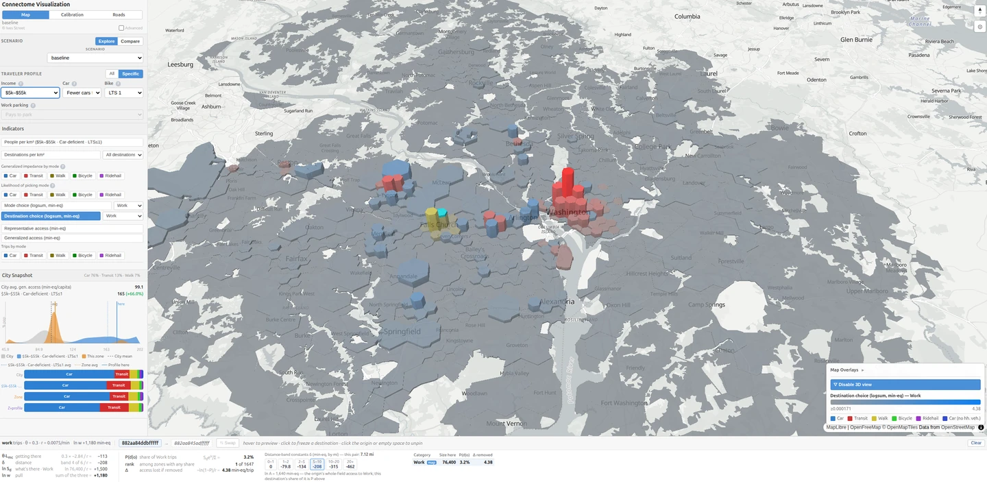
The source code of Connectome is fully source-available under a license that makes it free for public agencies, nonprofits, and educational institutions to use for any purpose. Private firms can view and run the code but can't use it in production without a separate agreement. Read our announcement or view the codebase.
Ives Street offers Connectome calibration, scenario analysis, and planning analysis as services. See Services.
Ives Street offers travel demand modeling and planning analysis under the Connectome™ name, built on our own Connectome software.
We calibrate a Connectome model to your city or region, including travel demand analysis and traffic assignment. We use open data sources for calibration by default, but can supplement them with any kind of regional data. You can use your existing transportation analysis zones or we create a new set at any resolution. Your agency will have access to the source code of the calibrated model for unlimited in-house use. Calibration is typically delivered within eight weeks.
We apply your calibrated Connectome model to study scenarios. This may include changes to the roadway network, public transport, walking or bicycling infrastructure, road pricing, land use changes, etc. We particularly specialize in capturing the effects of induced travel. Scenario analysis can be used for long-range strategic planning, for comparing alternatives in a corridor or district plan, or for project prioritization.
We build, publish, and host Connectome Viewer interactive visualizations to communicate every part of the regional model. These can include detailed breakdowns of every factor to inform analysts, or they can represent key results for communication with non-technical stakeholders or the public.
Planning studies can't always afford the time or cost of a conventional travel demand model, so they fall back on simpler tools that miss the interactions between modes, traffic, and land use. Connectome analysis changes that arithmetic: we bring model-grade analysis to corridor studies, district and comprehensive plans, and project prioritization, and we do it on a planning study's timeline and budget. We work at any scale, from a small town to a major metropolitan region, serving agencies directly or joining consultant teams.

Ives Street assessed the implications of a potential change to Michigan's fee for electric vehicles.
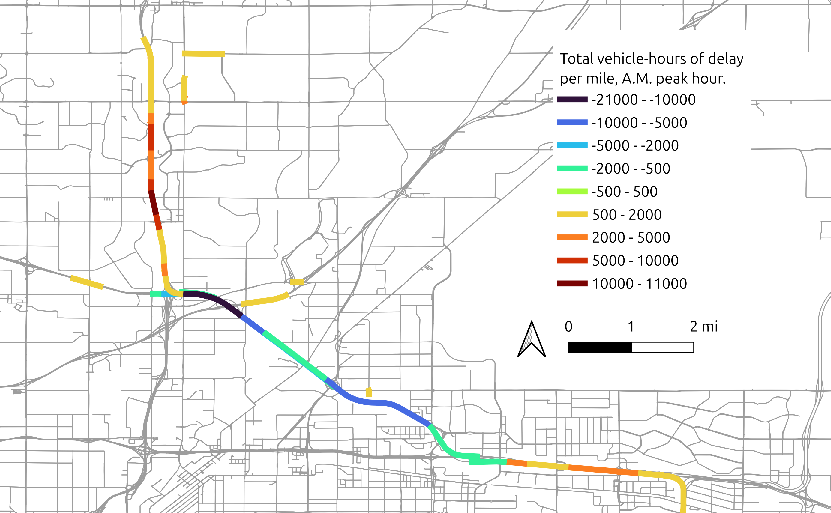
An independent traffic study of a potential Interstate widening in the Denver region, including induced travel.

Ives Street supported an analysis of the climate impacts of U.S. Federal Surface Transportation Reauthorization.
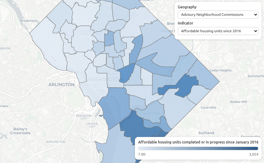
Ives Street mapped neighborhood characteristics across D.C. to support comprehensive planning.
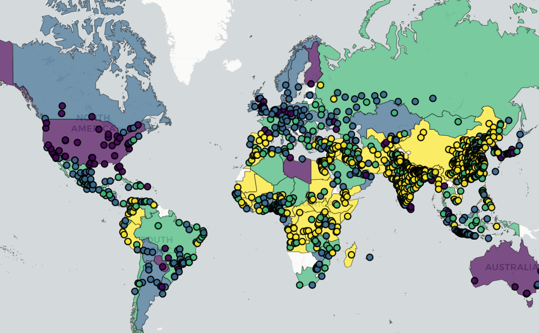
The world's most complete database of indicators of sustainable transportation.
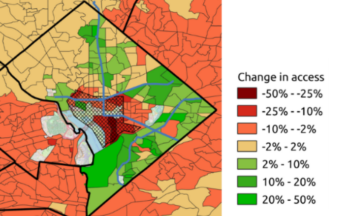
An assessment of potential road pricing in Washington DC, using Connectome.






they/them
Principal
Taylor Reich is the founder of Ives Street, a transportation modeler, and the lead developer of Connectome. They build travel demand models for planning decisions, and their specialty is translating complex issues between modeling, planning, and decisionmaking. Previously, Taylor served as Data Science Manager at the Institute for Transportation and Development Policy. Their work has informed national decisionmaking in the USA, India, and Mexico, and has received media attention from outlets in over 20 countries, including the Guardian and the BBC. Taylor also sits on the Board of Directors of MobilityData, the international data standards organization for public and shared mobility.
Ives Street draws on a wide bench of experts to build teams that meet the needs of our clients. We work closely with collaborators who have expertise in areas including geospatial data science, public transport planning, traffic assignment algorithms, data visualization, and federal transport policy.